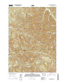
2014 Map of Burnt Mountain
USGS Topo · Published 2014About this map
Burnt Mountain stands at the center of this 2014 survey, highlighting the complex drainage patterns and ridgelines that divide the headwaters of the Willamette and Umpqua river basins. The Lane Co Douglas Co boundary runs east-to-west across the sheet, following the high ground of the Calapooya Divide. This watershed is defined by high-elevation landmarks such as Kellys Bluff, Marion Butte, and Pilot Rock, which overlook the natural passage at Shirley Gap.
Find a feature on this map
84 named features on this map. Tap any name to fly to it.
Don’t see what you’re looking for? This feature index may not catch every label — zoom into the map to look around manually.
Map Details
Editions of this 2014 Burnt Mountain Map
This is the sole edition of this map. No revisions or reprints were ever made.
Other maps of this area

1897 · Roseburg
USGS Topo · 1:125,000

1900 · Roseburg
USGS Topo · 1:125,000

1935 · Lowell
USGS Topo · 1:96,000

1942 · Lowell
USGS Topo · 1:125,000

1954 · Anlauf
USGS Topo · 1:62,500

1954 · Glide
USGS Topo · 1:62,500

1955 · Mace Mtn
USGS Topo · 1:62,500

1955 · Culp Creek
USGS Topo · 1:62,500

1958 · Roseburg
USGS Topo · 1:250,000

1959 · Roseburg
USGS Topo · 1:250,000