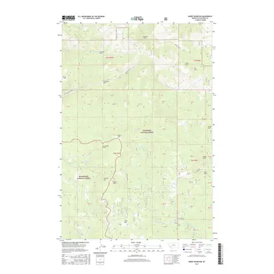
2017 Map of Burnt Mountain
USGS Topo · Published 2017About this map
The Continental Divide winds through this high-altitude landscape southwest of Butte, marking the structural backbone of the region. This 2017 survey shows the transition between the Deerlodge National Forest and the Beaverhead National Forest, a terrain dominated by drainage systems like German Gulch and N Fork Divide Cr. The prominence of Fleecer Ridge and Starlight Mtn defines the local topography, which is carved by numerous namesake gulches including American Gulch, Greenland Gulch, and Powder Gulch. Human infrastructure is limited to rugged corridors such as German Gulch Rd and Divide Creek Rd, reflecting the area's primary role as protected forest and watershed land. Researchers will find a preserved wilderness where Delano Spring and Olson Park provide specific landmarks within the larger national forest system.
Find a feature on this map
34 named features on this map. Tap any name to fly to it.
Don’t see what you’re looking for? This feature index may not catch every label — zoom into the map to look around manually.
Map Details
Editions of this 2017 Burnt Mountain Map
This is the sole edition of this map. No revisions or reprints were ever made.
Other maps of this area

1889 · Helena
USGS Topo · 1:250,000

1893 · Helena
USGS Topo · 1:250,000

1893 · Dillon
USGS Topo · 1:250,000

1899 · Helena
USGS Topo · 1:250,000

1903 · Helena
USGS Topo · 1:250,000

1947 · Butte
USGS Topo · 1:250,000

1955 · Dillon
USGS Topo · 1:250,000

1957 · Dillon
USGS Topo · 1:250,000

1958 · Butte
USGS Topo · 1:250,000

1958 · Dillon
USGS Topo · 1:250,000