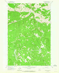
1961 Map of Burnt Mountain
USGS Topo · Published 1964About this map
The Continental Divide snake-like through this portion of the Montana high country, separating the Deerlodge National Forest from the Beaverhead National Forest. This 1961 field-checked survey reveals a landscape defined by sharp ridges and isolated outposts, where family-named sites like Scuichetti Place, Delano Place, and the Bull Ranch represent the legacy of high-altitude ranching and settlement.
Find a feature on this map
31 named features on this map. Tap any name to fly to it.
Don’t see what you’re looking for? This feature index may not catch every label — zoom into the map to look around manually.
Map Details
Editions of this 1961 Burnt Mountain Map
This is the sole edition of this map. No revisions or reprints were ever made.
Other maps of this area

1889 · Helena
USGS Topo · 1:250,000

1893 · Helena
USGS Topo · 1:250,000

1893 · Dillon
USGS Topo · 1:250,000

1899 · Helena
USGS Topo · 1:250,000

1903 · Helena
USGS Topo · 1:250,000

1947 · Butte
USGS Topo · 1:250,000

1955 · Dillon
USGS Topo · 1:250,000

1957 · Dillon
USGS Topo · 1:250,000

1958 · Butte
USGS Topo · 1:250,000

1958 · Dillon
USGS Topo · 1:250,000