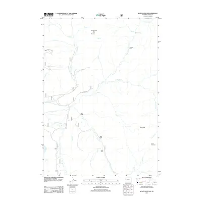
2012 Map of Burnt Mountain
USGS Topo · Published 2012About this map
The Gros Ventre River snakes through this high-country landscape in Teton County, defining a complex drainage system that includes Soda Lake and numerous alpine creeks. The terrain is marked by high-altitude vantage points such as Deer Creek Lookout on Deer Creek Mountain and the Bull Creek Patrol Cabin, indicating the area's significance for forest management and fire observation.
Find a feature on this map
33 named features on this map. Tap any name to fly to it.
Don’t see what you’re looking for? This feature index may not catch every label — zoom into the map to look around manually.
Map Details
Editions of this 2012 Burnt Mountain Map
This is the sole edition of this map. No revisions or reprints were ever made.
Other maps of this area

1902 · Mt Leidy
USGS Topo · 1:125,000

1907 · Gros Ventre
USGS Topo · 1:125,000

1910 · Gros Ventre
USGS Topo · 1:125,000

1955 · Driggs
USGS Topo · 1:250,000

1958 · Driggs
USGS Topo · 1:250,000

1962 · Driggs
USGS Topo · 1:250,000

1965 · Green Mountain
USGS Topo · 1:24,000
1965 · Lava Mountain
USGS Topo · 1:24,000
1965 · Sheridan Pass
USGS Topo · 1:24,000
1965 · Upper Slide Lake
USGS Topo · 1:24,000