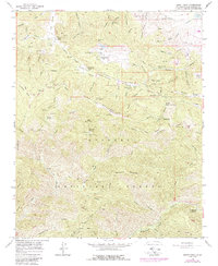
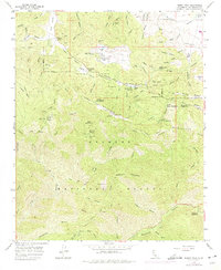
1958 Map of Burnt Peak
USGS Topo · Published 1988About this map
The San Andreas Rift Zone slices through this high-elevation terrain in the Angeles National Forest, creating a unique landscape of fracture-controlled valleys and ridges. This mid-century survey documents the intersection of geological forces and human infrastructure, most notably where the Los Angeles Aqueduct crosses the northeast corner near Percolation Basin. The rugged topography, crowned by Burnt Peak and Sawmill Mountain, is punctuated by isolated outposts like Hidden Lake Ranch and Tweedy Lake Club, which likely served as seasonal mountain retreats.
Find a feature on this map
63 named features on this map. Tap any name to fly to it.
Don’t see what you’re looking for? This feature index may not catch every label — zoom into the map to look around manually.
Map Details
Editions of this 1958 Burnt Peak Map
5 editions found
Other maps of this area

1903 · Tejon
USGS Topo · 1:125,000

1915 · Elizabeth Lake
USGS Topo · 1:125,000

1917 · Elizabeth Lake
USGS Topo · 1:125,000

1931 · Warm Spring
USGS Topo · 1:24,000

1931 · Redrock Mtn
USGS Topo · 1:24,000

1932 · Hughes Lake
USGS Topo · 1:24,000

1932 · Fairmont
USGS Topo · 1:24,000

1932 · Neenach
USGS Topo · 1:24,000

1933 · Manzana
USGS Topo · 1:24,000
1936 · Warm Spring
USGS Topo · 1:24,000