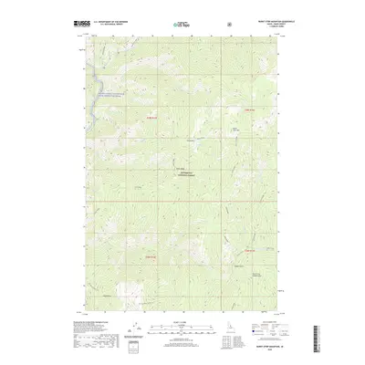
2020 Map of Burnt Strip Mountain
USGS Topo · Published 2020About this map
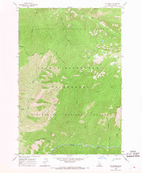
Bitterroot National Forest encompasses this high-elevation terrain in Idaho County, Idaho, where the landscape is defined by the steep drainage basins of the Middle Fork Clearwater Wild and Scenic River. Tracing the southwestern corner of the map, the historic Nez Perce Indian Trail follows a path through Steep Gulch, providing a glimpse into the ancient travel routes that predate modern federal management. The geography is dominated by a series of prominent divides, including Indian Ridge and Burnt Strip Ridge, which separate the myriad tributaries flowing toward the river. Named landmarks like Burnt Strip Mtn and Green Mtn rise above deep canyons carved by White Cap Creek, Jack Cr, and Schofield Cr. This modern survey records the enduring wilderness character of the region, emphasizing the complex network of ridges and gulches such as Saddle Gulch and Bad Luck Ridge that have long challenged travel through the Idaho interior.
Find a feature on this map
27 named features on this map. Tap any name to fly to it.
Don’t see what you’re looking for? This feature index may not catch every label — zoom into the map to look around manually.
Map Details
Editions of this 2020 Burnt Strip Mountain Map
This is the sole edition of this map. No revisions or reprints were ever made.
Other maps of this area

1956 · Elk City
USGS Topo · 1:250,000

1960 · Elk City
USGS Topo · 1:250,000

1962 · Beaver Jack Mtn
USGS Topo · 1:24,000

1962 · Nez Perce Peak
USGS Topo · 1:24,000

1966 · Watchtower Peak
USGS Topo · 1:24,000

1966 · Spot Mountain
USGS Topo · 1:24,000
1966 · Mount Paloma
USGS Topo · 1:24,000
1966 · Burnt Strip Mtn
USGS Topo · 1:24,000
1966 · Gardiner Peak
USGS Topo · 1:24,000
1966 · Mt George
USGS Topo · 1:24,000