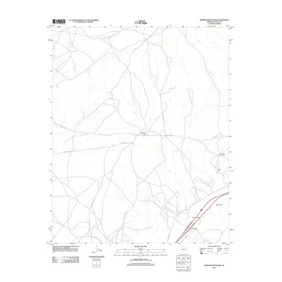
2011 Map of Burntwater Wash
USGS Topo · Published 2011About this map
Burntwater Trading Post serves as a central landmark in this high-desert landscape of Apache County, situated at the junction of Indian Rte 9405 and Indian Rte 9406. This 2011 survey documents a complex network of dry watercourses and essential water sources, including John Silver Spring Well and Murphy Well, which have long supported life in this arid region. The southern portion of the map transitions toward more developed infrastructure at the Querino Interchange, where modern transport intersects with the ancient natural corridor of the Puerco River. Steep topography is most evident at Box Canyon and the nearby Box Canyon Springs, features that define the drainage patterns of Burntwater Wash and Querino Wash. The map reflects a remote territory managed by the Fort Defiance Agency, characterized by extensive tribal route systems like Indian Rte 2011.
Find a feature on this map
18 named features on this map. Tap any name to fly to it.
Don’t see what you’re looking for? This feature index may not catch every label — zoom into the map to look around manually.
Map Details
Editions of this 2011 Burntwater Wash Map
This is the sole edition of this map. No revisions or reprints were ever made.
Other maps of this area

1886 · Fort Defiance
USGS Topo · 1:250,000

1892 · Fort Defiance
USGS Topo · 1:250,000

1954 · Gallup
USGS Topo · 1:250,000

1958 · Gallup
USGS Topo · 1:250,000

1959 · Gallup
USGS Topo · 1:250,000

1962 · Gallup
USGS Topo · 1:250,000

1967 · Gallup
USGS Topo · 1:250,000

1971 · Wide Ruins
USGS Topo · 1:24,000

1971 · Burntwater Wash
USGS Topo · 1:24,000
1971 · Uranium Spring
USGS Topo · 1:24,000