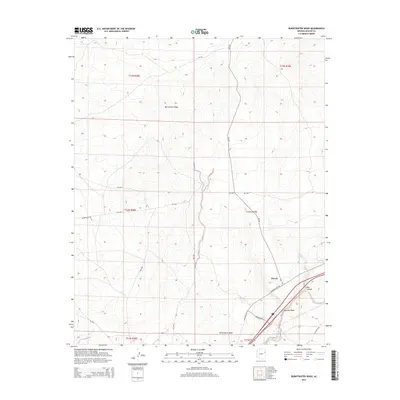
2014 Map of Burntwater Wash
USGS Topo · Published 2014About this map
Houck sits near the southeastern corner of this high-desert landscape, where the seasonal waters of Querino Wash and Burntwater Wash eventually converge toward the Puerco River. The map reveals a network of Bureau of Indian Affairs routes, such as Bia-201 and Bia-9405, that navigate the complex drainage patterns and arid plateaus. Natural water sources are scarce, making Box Canyon Springs and the sheltered terrain of Box Canyon significant landmarks for those navigating the region's topography. The transition from the open washes to the rugged incisions of the canyons illustrates the erosive power of the intermittent waterways that define this section of the Arizona-Apache Co. borderlands.
Find a feature on this map
23 named features on this map. Tap any name to fly to it.
Don’t see what you’re looking for? This feature index may not catch every label — zoom into the map to look around manually.
Map Details
Editions of this 2014 Burntwater Wash Map
This is the sole edition of this map. No revisions or reprints were ever made.
Other maps of this area

1886 · Fort Defiance
USGS Topo · 1:250,000

1892 · Fort Defiance
USGS Topo · 1:250,000

1954 · Gallup
USGS Topo · 1:250,000

1958 · Gallup
USGS Topo · 1:250,000

1959 · Gallup
USGS Topo · 1:250,000

1962 · Gallup
USGS Topo · 1:250,000

1967 · Gallup
USGS Topo · 1:250,000

1971 · Wide Ruins
USGS Topo · 1:24,000

1971 · Burntwater Wash
USGS Topo · 1:24,000
1971 · Uranium Spring
USGS Topo · 1:24,000