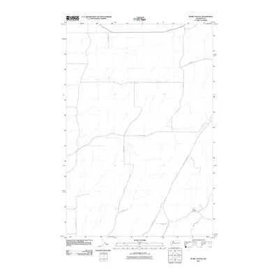
2011 Map of Burr Canyon
USGS Topo · Published 2011About this map
Burr Canyon defines the southeastern geography of this rural Franklin County landscape, where the drainage patterns and coulees of the Columbia Plateau dictate the placement of a sparse but deliberate road network. Agricultural land use is evident in the rectilinear grid of local routes like Hoffman Rd and Largent Rd in the north, while the southern terrain is navigated by the curving path of the Pasco Kahlotus Rd. This 2011 survey records a region where transportation remains tied to the natural topography of the canyon system and the needs of a dryland farming economy. Researchers can trace family-named thoroughfares such as Reynolds Rd, Essenprise Rd, and Neff Jones Rd, which connect the isolated homesteads and fields across the undulating terrain between Richmond Rd and McCallum Rd.
Find a feature on this map
14 named features on this map. Tap any name to fly to it.
Don’t see what you’re looking for? This feature index may not catch every label — zoom into the map to look around manually.
Map Details
Editions of this 2011 Burr Canyon Map
This is the sole edition of this map. No revisions or reprints were ever made.
Other maps of this area

1915 · Wallulah
USGS Topo · 1:96,000

1916 · Connell
USGS Topo · 1:125,000

1918 · Connell
USGS Topo · 1:125,000

1918 · Wallula
USGS Topo · 1:125,000

1953 · Walla Walla
USGS Topo · 1:250,000

1958 · Walla Walla
USGS Topo · 1:250,000

1964 · Levey NE
USGS Topo · 1:24,000

1966 · Snake River
USGS Topo · 1:24,000
1966 · Elwood
USGS Topo · 1:24,000
1970 · Burr Canyon
USGS Topo · 1:24,000