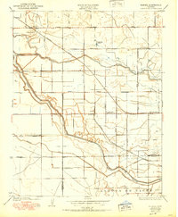
1950 Map of Burrel
USGS Topo · Published 1950About this map
Burrel and Lanare anchor this central California landscape during the mid-century, where the transition from riparian wetlands to organized agriculture is clearly visible. The survey captures a network of irrigation ditches and sloughs, most notably the meandering Fresno Slough and Murphy Slough, which cut through a strictly gridded system of section roads. The rural infrastructure is dense with local history markers, including several eponymous educational sites such as Elkhorn School, Bender School, and Crescent School. Large agricultural holdings like Burrel Ranch and West Lake Ranch illustrate the scale of land use in the San Joaquin Valley. Transportation is defined by the competing routes of the Southern Pacific and the Atchison Topeka and Santa Fe railroads, which facilitated the movement of goods from these remote agricultural hubs. The southern portion of the map follows the boundary with the Fresno and Kings County line near the Laguna de Tache.
Find a feature on this map
36 named features on this map. Tap any name to fly to it.
Don’t see what you’re looking for? This feature index may not catch every label — zoom into the map to look around manually.
Map Details
Editions of this 1950 Burrel Map
This is the sole edition of this map. No revisions or reprints were ever made.
Other maps of this area

1912 · Coalinga
USGS Topo · 1:125,000

1924 · Riverdale
USGS Topo · 1:31,680

1925 · Helm
USGS Topo · 1:31,680

1925 · Raisin
USGS Topo · 1:31,680

1925 · Caruthers
USGS Topo · 1:31,680

1926 · Lethent
USGS Topo · 1:31,680

1927 · Burrel
USGS Topo · 1:31,680

1927 · Riverdale
USGS Topo · 1:31,680

1927 · Lemoore
USGS Topo · 1:31,680

1931 · Wheatville
USGS Topo · 1:31,680