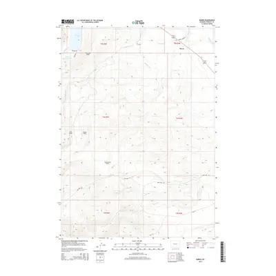
2015 Map of Burris
USGS Topo · Published 2015About this map
The small settlement of Burris sits along the Wind River drainage in this contemporary survey of Fremont County. This high-altitude landscape is defined by its complex irrigation network, necessary for sustaining life and agriculture in the arid basin. Water management is visibly central to the area's geography, with the Dinwoody Canal, Dry Cr Canal, and Wind River Canal cutting through the terrain to distribute flow from Dinwoody Creek.
Find a feature on this map
28 named features on this map. Tap any name to fly to it.
Don’t see what you’re looking for? This feature index may not catch every label — zoom into the map to look around manually.
Map Details
Editions of this 2015 Burris Map
This is the sole edition of this map. No revisions or reprints were ever made.
Other maps of this area

1952 · Wilderness
USGS Topo · 1:24,000

1952 · Hays Park
USGS Topo · 1:24,000

1952 · Crowheart NW
USGS Topo · 1:24,000

1952 · Bob Lakes
USGS Topo · 1:24,000

1952 · Bull Lake West
USGS Topo · 1:24,000

1952 · Blue Holes
USGS Topo · 1:24,000

1952 · Crowheart
USGS Topo · 1:24,000

1952 · Burris
USGS Topo · 1:24,000

1952 · Kirkland Park
USGS Topo · 1:24,000

1955 · Thermopolis
USGS Topo · 1:250,000