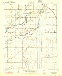
1950 Map of Burris Park
USGS Topo · Published 1950About this map
The Kings River carves a winding path through this San Joaquin Valley landscape, where an intricate network of irrigation channels defines the agricultural character of the region. The map reveals the critical importance of water management in the mid-century, shown through named canals and ditches like Peoples Ditch, Settlers Ditch, and Emigrant DITCH. These waterways support the dispersed rural settlements anchored by local institutions such as River Bend School, Oakvale School, and Excelsior School.
Find a feature on this map
42 named features on this map. Tap any name to fly to it.
Don’t see what you’re looking for? This feature index may not catch every label — zoom into the map to look around manually.
Map Details
Editions of this 1950 Burris Park Map
This is the sole edition of this map. No revisions or reprints were ever made.
Other maps of this area

1922 · Trimmer
USGS Topo · 1:96,000

1924 · Reedley
USGS Topo · 1:31,680

1924 · Selma
USGS Topo · 1:31,680

1924 · Conejo
USGS Topo · 1:31,680

1924 · Dinuba
USGS Topo · 1:125,000

1926 · Goshen
USGS Topo · 1:31,680

1926 · Hanford
USGS Topo · 1:31,680

1926 · Burris Park
USGS Topo · 1:31,680

1927 · Traver
USGS Topo · 1:31,680

1927 · Laton
USGS Topo · 1:31,680