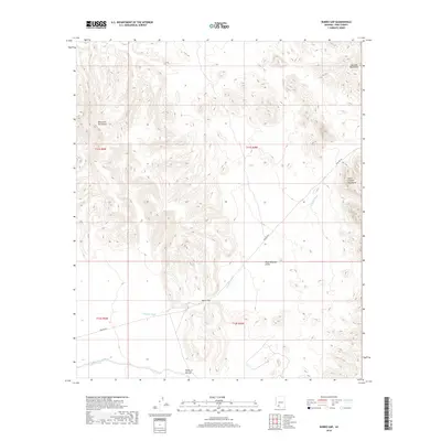
2018 Map of Burro Gap
USGS Topo · Published 2018About this map
Burro Gap serves as a central passage through a landscape dominated by the arid basins and ranges of southern Arizona. This 2018 survey illustrates a region where life and travel are dictated by the desert floor, with the Pozo Redondo Valley and the Valley of the Ajo providing the primary lowlands. Modern infrastructure is represented by the straight path of Pipeline Rd, which cuts across the southern portion of the sheet. The terrain is defined by the proximity of the Sauceda Mountains, the Batamote Mountains, and the Sikort Chuapo Mountains, while ephemeral water features like Tenmile Wash and Sikort-Chuapo Wash provide a record of how water moves through this part of Pima County during seasonal rains.
Find a feature on this map
13 named features on this map. Tap any name to fly to it.
Don’t see what you’re looking for? This feature index may not catch every label — zoom into the map to look around manually.
Map Details
Editions of this 2018 Burro Gap Map
This is the sole edition of this map. No revisions or reprints were ever made.
Other maps of this area

1932 · Ajo
USGS Topo · 1:62,500

1934 · Ajo
USGS Topo · 1:62,500

1953 · Ajo
USGS Topo · 1:250,000

1957 · Ajo
USGS Topo · 1:250,000

1958 · Ajo
USGS Topo · 1:250,000

1958 · Midway
USGS Topo · 1:62,500

1958 · Hat Mountain
USGS Topo · 1:62,500

1962 · Ajo
USGS Topo · 1:250,000

1963 · Ajo
USGS Topo · 1:250,000

1963 · Ajo
USGS Topo · 1:62,500