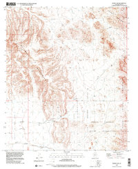
1996 Map of Burro Gap
USGS Topo · Published 2001About this map
The Tohono O'odham Indian Reservation dominates the southeastern quadrant of this landscape, where the arid flats meet the dramatic rises of the Sikort Chuapo Mountains. This desert region is defined by broad basins and steep mountain fronts, notably the Batamote Mountains to the west and the Sauceda Mountains in the northeast. Central to the map's geography is Burro Gap, a natural passage between the uplands that connects the Valley of the Ajo with the Pozo Redondo Valley.
Find a feature on this map
16 named features on this map. Tap any name to fly to it.
Don’t see what you’re looking for? This feature index may not catch every label — zoom into the map to look around manually.
Map Details
Editions of this 1996 Burro Gap Map
This is the sole edition of this map. No revisions or reprints were ever made.
Other maps of this area

1932 · Ajo
USGS Topo · 1:62,500

1934 · Ajo
USGS Topo · 1:62,500

1953 · Ajo
USGS Topo · 1:250,000

1957 · Ajo
USGS Topo · 1:250,000

1958 · Ajo
USGS Topo · 1:250,000

1958 · Midway
USGS Topo · 1:62,500

1958 · Hat Mountain
USGS Topo · 1:62,500

1962 · Ajo
USGS Topo · 1:250,000

1963 · Ajo
USGS Topo · 1:250,000

1963 · Ajo
USGS Topo · 1:62,500