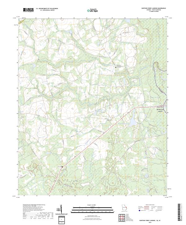
2024 Map of Burtons Ferry Landing
USGS Topo · Published 2024About this map
The Savannah River defines the eastern boundary of this Georgia and South Carolina borderland, where the Savannah National Wildlife Refuge preserves the bottomlands of the lower river basin. Historically significant for river transport, Burtons Ferry Landing marks a vital crossing point between Screven and Allendale counties. The landscape is a network of slow-moving water and seasonal wetlands, including Wade Lake Number One, Wade Lake Number Two, and Millhaven Pond, all tied to the drainage of Beaverdam Creek and Rocky Creek. Near the settlement of Millhaven, the map reveals a history of local community life through sites like the Bethel Brick United Methodist Church Cem and the Meek Cem. These landmarks, alongside the historic Oglethorpe Trl, illustrate the transition from early river-based economy to modern conservation and land management.
Find a feature on this map
46 named features on this map. Tap any name to fly to it.
Don’t see what you’re looking for? This feature index may not catch every label — zoom into the map to look around manually.
Map Details
Editions of this 2024 Burtons Ferry Landing Map
This is the sole edition of this map. No revisions or reprints were ever made.
Other maps of this area

1919 · Allendale
USGS Topo · 1:62,500

1920 · Ellenton
USGS Topo · 1:48,000

1920 · Hilltonia
USGS Topo · 1:62,500

1920 · Peeples
USGS Topo · 1:62,500

1921 · Ellenton
USGS Topo · 1:62,500

1943 · Allendale
USGS Topo · 1:62,500

1943 · Hilltonia
USGS Topo · 1:62,500

1943 · Peeples
USGS Topo · 1:62,500

1943 · Augusta East
USGS Topo · 1:125,000

1943 · Millen
USGS Topo · 1:125,000