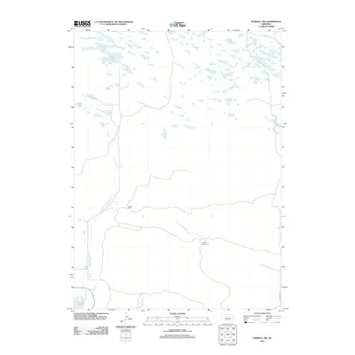
2011 Map of Burwell NW
USGS Topo · Published 2011About this map
Dry Creek carves a winding path through this corner of the Nebraska Sandhills, feeding into the northern reaches of the Calamus Reservoir. The landscape is defined by its low-lying hydrology, where numerous unnamed basins sit alongside established water bodies like Nichol Lake and Bald Lake. This 2011 survey documents a rural environment where land use is oriented around isolated ranching outposts and foundational local infrastructure, such as the Garska Ranch and School Number 32. These features, connected by a network of local tracks and the prominent Windy Hill Rd, illustrate the enduring settlement patterns of Garfield County, where life remains tethered to the intermittent water sources and the vast grazing lands of the interior plains.
Find a feature on this map
7 named features on this map. Tap any name to fly to it.
Don’t see what you’re looking for? This feature index may not catch every label — zoom into the map to look around manually.
Map Details
Editions of this 2011 Burwell NW Map
This is the sole edition of this map. No revisions or reprints were ever made.
Other maps of this area

1952 · Burwell
USGS Topo · 1:24,000

1952 · Burwell SE
USGS Topo · 1:24,000

1952 · Burwell NE
USGS Topo · 1:24,000

1952 · Taylor SE
USGS Topo · 1:24,000

1952 · Burwell NW
USGS Topo · 1:24,000

1952 · Taylor NE
USGS Topo · 1:24,000

1955 · Broken Bow
USGS Topo · 1:250,000

1955 · O'Neill
USGS Topo · 1:250,000

1956 · Broken Bow
USGS Topo · 1:250,000

1959 · O'Neill
USGS Topo · 1:250,000