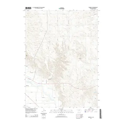
2014 Map of Burwell SE
USGS Topo · Published 2014About this map
Burwell serves as the focal point for this survey of the Garfield County landscape, situated where the North Loup River and the Burwell-Sumter Canal carve through the terrain. The map documents a rural environment defined by an organized grid of section roads and water management features essential to Nebraska agriculture. Notable local landmarks include Windy Hill and the rugged contours of Jones Canyon, while genealogical interests are represented by the West Side Cem and Banner Cem. The presence of Miller Reservoir and James Reservoir Number 1 alongside smaller tributaries like Bean Cr highlights the intricate network of water resources that support the area's homesteads and farms. This 2014 edition captures the established infrastructure of the region, from state highways like Ne-11 and Ne-91 to the numerous named avenues and roads that connect the isolated farmsteads and natural features of the Nebraska sandhills fringe.
Find a feature on this map
31 named features on this map. Tap any name to fly to it.
Don’t see what you’re looking for? This feature index may not catch every label — zoom into the map to look around manually.
Map Details
Editions of this 2014 Burwell SE Map
This is the sole edition of this map. No revisions or reprints were ever made.
Other maps of this area

1952 · Burwell
USGS Topo · 1:24,000

1952 · Elyria
USGS Topo · 1:24,000

1952 · Burwell SE
USGS Topo · 1:24,000

1952 · Burwell NE
USGS Topo · 1:24,000

1952 · Comstock NW
USGS Topo · 1:24,000

1952 · Burwell NW
USGS Topo · 1:24,000

1954 · Gables SW
USGS Topo · 1:24,000

1954 · Ord NW
USGS Topo · 1:24,000

1954 · Gables NW
USGS Topo · 1:24,000

1955 · Broken Bow
USGS Topo · 1:250,000