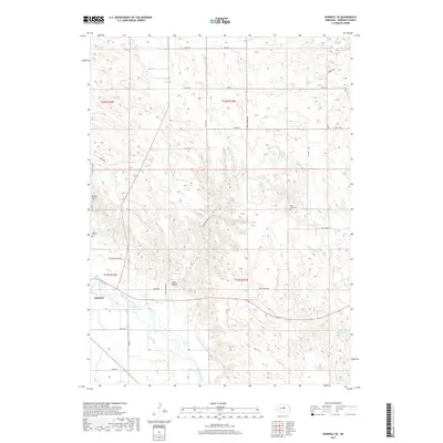
2017 Map of Burwell SE
USGS Topo · Published 2017About this map
Burwell occupies the southwestern corner of this survey, situated at a bend in the North Loup River. The landscape is defined by the vital water management of the Burwell-Sumter Canal, which traces the river valley to support local agriculture. The terrain shifts from the river bottomlands toward the dissected uplands of Jones Canyon and the prominent height of Windy Hill in the west. This 2017 record illustrates the persistent rural infrastructure of Garfield County, where long-standing landmarks like the Banner Cem and West Side Cem provide clear points of reference for local historians. Small water features like Bean Cr and the James Reservoir Number 1 punctuate the northern and eastern sections of the quadrangle, highlighting the essential role of water resources in this Nebraska prairie environment.
Find a feature on this map
69 named features on this map. Tap any name to fly to it.
Don’t see what you’re looking for? This feature index may not catch every label — zoom into the map to look around manually.
Map Details
Editions of this 2017 Burwell SE Map
This is the sole edition of this map. No revisions or reprints were ever made.
Other maps of this area

1952 · Burwell
USGS Topo · 1:24,000

1952 · Elyria
USGS Topo · 1:24,000

1952 · Burwell SE
USGS Topo · 1:24,000

1952 · Burwell NE
USGS Topo · 1:24,000

1952 · Comstock NW
USGS Topo · 1:24,000

1952 · Burwell NW
USGS Topo · 1:24,000

1954 · Gables SW
USGS Topo · 1:24,000

1954 · Ord NW
USGS Topo · 1:24,000

1954 · Gables NW
USGS Topo · 1:24,000

1955 · Broken Bow
USGS Topo · 1:250,000