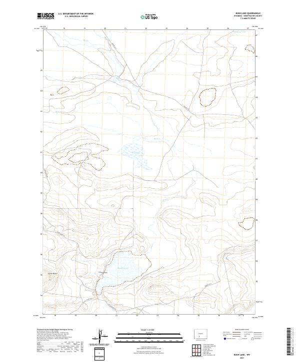
2021 Map of Bush Lake
USGS Topo · Published 2021About this map
Bush Lake and the surrounding high desert of Sweetwater County define this arid landscape in the early 21st century. The terrain is characterized by seasonal water sources and significant topographical shifts, ranging from the prominent Luman Butte in the southwest to the broad depressions of Cronin Draw. Drainage patterns are dictated by Red Cr and Bush Cr, which wind through a network of sections including parts of T24N R97W and T25N R96W. Remote access is provided by a system of unpaved tracks, most notably Tipton-North Rd and BLM Rd 3219. The inclusion of Hay Reservoir and the isolated Niland Spring highlights the critical importance of water management and stock points in this vast grazing and resource-extraction region of southern Wyoming.
Find a feature on this map
16 named features on this map. Tap any name to fly to it.
Don’t see what you’re looking for? This feature index may not catch every label — zoom into the map to look around manually.
Map Details
Editions of this 2021 Bush Lake Map
This is the sole edition of this map. No revisions or reprints were ever made.
Other maps of this area

1954 · Rock Springs
USGS Topo · 1:250,000

1955 · Lander
USGS Topo · 1:250,000

1958 · Lander
USGS Topo · 1:250,000

1958 · Rock Springs
USGS Topo · 1:250,000

1960 · Red Lake
USGS Topo · 1:62,500

1960 · Lost Creek Butte
USGS Topo · 1:62,500

1960 · Five Fingers Butte
USGS Topo · 1:62,500

1960 · Lost Creek Lake
USGS Topo · 1:62,500

1961 · Lander
USGS Topo · 1:250,000

1962 · Rock Springs
USGS Topo · 1:250,000