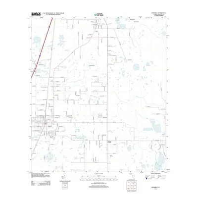
2012 Map of Bushnell
USGS Topo · Published 2012About this map
Bushnell serves as a central hub in this central Florida landscape, surrounded by a network of smaller communities like Carver, Lincoln Park, and Bevilles Corner. The terrain is defined by a complex mosaic of hydrologic features and open grasslands, including Dog Fennel Prairie and Clark Prairie, alongside distinctive karst formations such as Walled Sink and Double Sink. To the north, the settlement of Sumterville is situated near several large water bodies, including Annie Marsh Pond and Sawgrass Pond. Local history and genealogy interest is anchored by several well-marked burial sites such as Evergreen Cemetery and Mount Zion Cemetery, while modern infrastructure is represented by the Cheryl-Lane Landings Airport and both the Bushnell Tower and Sumter Lookout Tower. This survey documents a transition between established agricultural lands and more modern developments along the county road corridors.
Find a feature on this map
134 named features on this map. Tap any name to fly to it.
Don’t see what you’re looking for? This feature index may not catch every label — zoom into the map to look around manually.
Map Details
Editions of this 2012 Bushnell Map
This is the sole edition of this map. No revisions or reprints were ever made.
Other maps of this area

1893 · Panasoffkee
USGS Topo · 1:62,500

1895 · Panasoffkee
USGS Topo · 1:62,500

1955 · Plant City
USGS Topo · 1:250,000

1955 · Orlando
USGS Topo · 1:250,000

1957 · Orlando
USGS Topo · 1:250,000

1958 · Orlando
USGS Topo · 1:250,000

1958 · Plant City
USGS Topo · 1:250,000

1958 · Webster
USGS Topo · 1:24,000

1958 · Bushnell
USGS Topo · 1:24,000

1958 · Wahoo
USGS Topo · 1:24,000