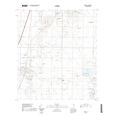
2021 Map of Bushnell
USGS Topo · Published 2021About this map
Sumterville and the surrounding prairies of Sumter County define this landscape, where the Sumter County Courthouse in Bushnell anchors the region's civic life. The terrain is a complex network of wetlands and karst features, evidenced by Walled Sink and Double Sink to the northeast and the expansive Towns Prairie in the center of the sheet. Water management is a visible priority, with the Jumper Creek Canal cutting across the landscape to drain the low-lying areas between Wildwood and Lincoln Park.
Find a feature on this map
138 named features on this map. Tap any name to fly to it.
Don’t see what you’re looking for? This feature index may not catch every label — zoom into the map to look around manually.
Map Details
Editions of this 2021 Bushnell Map
This is the sole edition of this map. No revisions or reprints were ever made.
Other maps of this area

1893 · Panasoffkee
USGS Topo · 1:62,500

1895 · Panasoffkee
USGS Topo · 1:62,500

1955 · Plant City
USGS Topo · 1:250,000

1955 · Orlando
USGS Topo · 1:250,000

1957 · Orlando
USGS Topo · 1:250,000

1958 · Orlando
USGS Topo · 1:250,000

1958 · Plant City
USGS Topo · 1:250,000

1958 · Webster
USGS Topo · 1:24,000

1958 · Bushnell
USGS Topo · 1:24,000

1958 · Wahoo
USGS Topo · 1:24,000