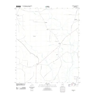
2011 Map of Bussey
USGS Topo · Published 2011About this map
Bayou Dorcheat and its tributaries, including Bridge Creek and Mill Creek, define the low-lying drainage patterns of this southwest Arkansas landscape. Scattered rural settlements such as Bussey, Friendship, and Sharman are linked by a network of county and state roads, including Columbia Road 15 and Columbia Road 50. The area’s economic history is anchored by the McKamie Patton Oil Field in the northwest corner, highlighting the region's reliance on natural resource extraction. Genealogy researchers can find several established burial grounds, such as Rocky Mount Cemetery near Smithland and Sharman Cemetery, which serve as vital markers for family history in these small communities. The presence of place names like Experiment suggests the localized agricultural or industrial trials common to the development of Columbia County.
Find a feature on this map
35 named features on this map. Tap any name to fly to it.
Don’t see what you’re looking for? This feature index may not catch every label — zoom into the map to look around manually.
Map Details
Editions of this 2011 Bussey Map
This is the sole edition of this map. No revisions or reprints were ever made.
Other maps of this area

1952 · Bradley NE
USGS Topo · 1:24,000

1952 · Lewisville
USGS Topo · 1:24,000

1952 · Bradley SE
USGS Topo · 1:24,000

1953 · El Dorado
USGS Topo · 1:250,000

1957 · El Dorado
USGS Topo · 1:250,000

1958 · El Dorado
USGS Topo · 1:250,000

1960 · El Dorado
USGS Topo · 1:250,000

1960 · Bussey
USGS Topo · 1:24,000
1960 · Taylor
USGS Topo · 1:24,000

1960 · Walkerville
USGS Topo · 1:24,000