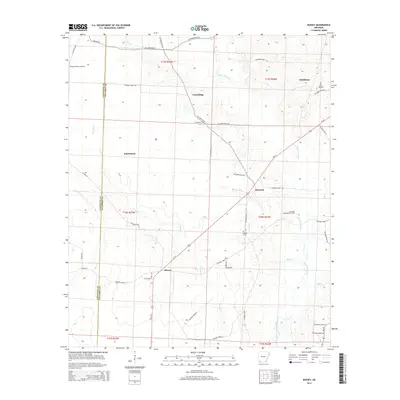
2014 Map of Bussey
USGS Topo · Published 2014About this map
Bayou Dorcheat and its various tributaries, including Bridge Cr and Big Cr, wind through this southwest Arkansas landscape, defining the topography of Columbia and Lafayette counties. The region's economy and settlement patterns are clearly tied to its natural resources, most notably evidenced by the extensive McKamie Patton Oil Field and the Dorcheat Macedonia Oil Field that span the northern and eastern portions of the map.
Find a feature on this map
51 named features on this map. Tap any name to fly to it.
Don’t see what you’re looking for? This feature index may not catch every label — zoom into the map to look around manually.
Map Details
Editions of this 2014 Bussey Map
This is the sole edition of this map. No revisions or reprints were ever made.
Other maps of this area

1952 · Bradley NE
USGS Topo · 1:24,000

1952 · Lewisville
USGS Topo · 1:24,000

1952 · Bradley SE
USGS Topo · 1:24,000

1953 · El Dorado
USGS Topo · 1:250,000

1957 · El Dorado
USGS Topo · 1:250,000

1958 · El Dorado
USGS Topo · 1:250,000

1960 · El Dorado
USGS Topo · 1:250,000

1960 · Bussey
USGS Topo · 1:24,000
1960 · Taylor
USGS Topo · 1:24,000

1960 · Walkerville
USGS Topo · 1:24,000