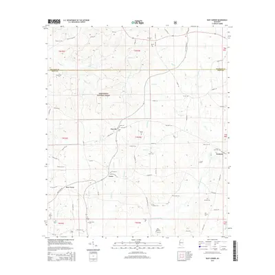
2015 Map of Busy Corner
USGS Topo · Published 2015About this map
The Homochitto National Forest dominates the landscape of this Amite and Franklin County borderland, where small settlements like Zion Hill and Busy Corner anchor a region defined by its timber and waterways. The drainage of the W Fork Amite River and numerous tributaries such as Zion Hill Cr and Butler Br carve the terrain, creating the distinct topographical patterns of southwestern Mississippi. For genealogists, the map is an exceptional resource, documenting nearly two dozen burial sites that reveal family lineages across the township, including the McGehee Cem, John Durham Cem, and Wactor Cem. The road network, including Rollinson Rd and Pecan Orchard Rd, connects these scattered homesteads and timberlands, providing a clear picture of local geography in the early twenty-first century near Brookside.
Find a feature on this map
76 named features on this map. Tap any name to fly to it.
Don’t see what you’re looking for? This feature index may not catch every label — zoom into the map to look around manually.
Map Details
Editions of this 2015 Busy Corner Map
This is the sole edition of this map. No revisions or reprints were ever made.
Other maps of this area

1953 · Natchez
USGS Topo · 1:250,000

1956 · Natchez
USGS Topo · 1:250,000

1959 · Natchez
USGS Topo · 1:250,000

1961 · Liberty
USGS Topo · 1:62,500

1962 · Bude
USGS Topo · 1:62,500

1972 · Smithdale
USGS Topo · 1:24,000

1972 · Little Springs
USGS Topo · 1:24,000

1972 · Peoria
USGS Topo · 1:24,000

1984 · McComb
USGS Topo · 1:100,000
1988 · Homochitto
USGS Topo · 1:24,000