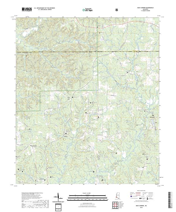
2024 Map of Busy Corner
USGS Topo · Published 2024About this map
Homochitto National Forest dominates the northwest corner of this landscape, where the Franklin and Amite county lines meet. The terrain is defined by a dense network of tributaries including Middleton Creek, Caston Creek, and Stokes Creek, which eventually feed into the West Fork Amite River as it winds through the south. This area is a significant corridor for family history, marked by a high density of rural burial grounds such as the Old-Parson Hill Cem, Whittington Memorial Cem, and Nunnery Cem. Small settlements like Ustane and Busy Corner serve as local anchors, while the Zion Hill Baptist Church stands as a notable landmark along the winding southern roads. The map illustrates a rural Mississippi economy built on timber and agriculture, connected by a web of local routes like Rollinson Rd and Coleman Rd.
Find a feature on this map
80 named features on this map. Tap any name to fly to it.
Don’t see what you’re looking for? This feature index may not catch every label — zoom into the map to look around manually.
Map Details
Editions of this 2024 Busy Corner Map
This is the sole edition of this map. No revisions or reprints were ever made.
Other maps of this area

1953 · Natchez
USGS Topo · 1:250,000

1956 · Natchez
USGS Topo · 1:250,000

1959 · Natchez
USGS Topo · 1:250,000

1961 · Liberty
USGS Topo · 1:62,500

1962 · Bude
USGS Topo · 1:62,500

1972 · Smithdale
USGS Topo · 1:24,000

1972 · Little Springs
USGS Topo · 1:24,000

1972 · Peoria
USGS Topo · 1:24,000

1984 · McComb
USGS Topo · 1:100,000
1988 · Homochitto
USGS Topo · 1:24,000