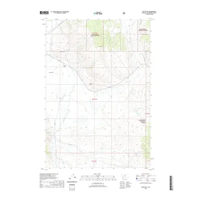
2020 Map of Butch Hill
USGS Topo · Published 2020About this map
The high-elevation landscape of Beaverhead National Forest dominates this Beaverhead County map, showcasing the intricate drainage patterns of the Montana backcountry. Centered on Butch Hill and the prominent Inabnit Butte, the terrain is defined by complex watersheds, including the long paths of Bull Creek and Cow Cabin Creek. Named landmarks like Davis Bench and Marys Gulch reflect a history of local geography where topography dictated movement and grazing.
Find a feature on this map
26 named features on this map. Tap any name to fly to it.
Don’t see what you’re looking for? This feature index may not catch every label — zoom into the map to look around manually.
Map Details
Editions of this 2020 Butch Hill Map
This is the sole edition of this map. No revisions or reprints were ever made.
Other maps of this area

1955 · Dillon
USGS Topo · 1:250,000

1957 · Dillon
USGS Topo · 1:250,000

1958 · Dillon
USGS Topo · 1:250,000

1959 · Polaris
USGS Topo · 1:62,500

1959 · Grant
USGS Topo · 1:62,500

1962 · Dillon
USGS Topo · 1:250,000

1965 · Dillon
USGS Topo · 1:250,000
1978 · Jackson
USGS Topo · 1:24,000

1978 · Butch Hill
USGS Topo · 1:24,000
1978 · Jackson Hill
USGS Topo · 1:24,000