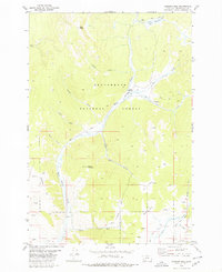
1978 Map of Jackson Hill
USGS Topo · Published 1979About this map
Beaverhead National Forest defines the character of this 1970s landscape, where high-country peaks and working cattle camps meet. The high ground is dominated by Deer Peak and Woody Mountain, with the prominent Jackson Hill rising above the headwaters. Evidence of local mountain industry and ranching appears at the Carney Mine and Clemow Cow Camp, while a network of high-elevation trails, including the Old Tim Creek Trail, suggests a terrain shaped by movement through the Knight Gulch and across Star Park. The drainage pattern is complex, feeding the valleys via Warm Springs Creek and human-made improvements like the Upper Gloss Ditch. This geography reflects the late-century balance of public land management and small-scale resource extraction typical of the Beaverhead region.
Find a feature on this map
34 named features on this map. Tap any name to fly to it.
Don’t see what you’re looking for? This feature index may not catch every label — zoom into the map to look around manually.
Map Details
Editions of this 1978 Jackson Hill Map
This is the sole edition of this map. No revisions or reprints were ever made.
Other maps of this area

1955 · Dillon
USGS Topo · 1:250,000

1957 · Dillon
USGS Topo · 1:250,000

1958 · Dillon
USGS Topo · 1:250,000

1959 · Polaris
USGS Topo · 1:62,500

1962 · Dillon
USGS Topo · 1:250,000

1962 · Wisdom
USGS Topo · 1:24,000

1962 · Stewart Mountain
USGS Topo · 1:24,000

1965 · Dillon
USGS Topo · 1:250,000
1978 · Odell Lake
USGS Topo · 1:24,000
1978 · Jackson
USGS Topo · 1:24,000