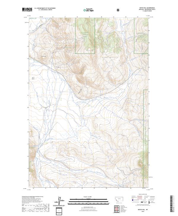
2024 Map of Butch Hill
USGS Topo · Published 2024About this map
The Pioneer Mountains define the high terrain of this Beaverhead County landscape, where the ridges of Butch Hill and the distinctive Inadnit Butte rise above the surrounding drainage basins. This area is characterized by an extensive network of water management features, including Wengers Ditch, Spencer Ditch, and the Main Jackson Ditch, which redirect water across the flats of Davis Bench. These irrigation systems reflect the ranching and agricultural requirements of the high-altitude Montana plains during the early twenty-first century.
Find a feature on this map
31 named features on this map. Tap any name to fly to it.
Don’t see what you’re looking for? This feature index may not catch every label — zoom into the map to look around manually.
Map Details
Editions of this 2024 Butch Hill Map
This is the sole edition of this map. No revisions or reprints were ever made.
Other maps of this area

1955 · Dillon
USGS Topo · 1:250,000

1957 · Dillon
USGS Topo · 1:250,000

1958 · Dillon
USGS Topo · 1:250,000

1959 · Polaris
USGS Topo · 1:62,500

1959 · Grant
USGS Topo · 1:62,500

1962 · Dillon
USGS Topo · 1:250,000

1965 · Dillon
USGS Topo · 1:250,000
1978 · Jackson
USGS Topo · 1:24,000

1978 · Butch Hill
USGS Topo · 1:24,000
1978 · Jackson Hill
USGS Topo · 1:24,000