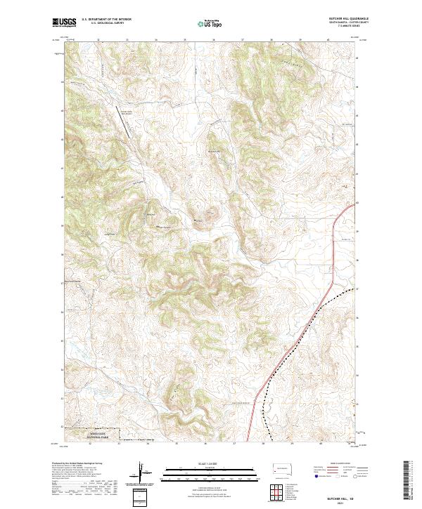
2021 Map of Butcher Hill
USGS Topo · Published 2021About this map
Wind Cave National Park borders the southern edge of this landscape, where the high ridges and deep draws of the Black Hills transition toward the plains. The terrain is defined by prominent elevations such as Butcher Hill and Racetrack Butte, alongside expansive level areas like Jolly Flats and Fisherman Flats. A network of watercourses including French Cr and the various forks of Lame Johnny Cr carve through the limestone and sandstone, creating significant features like Red Canyon and Bobcat Canyon. Civil engineering and park management are evident through the placement of the Custer State Park Airport and the winding course of the Wildlife Loop Rd. The map also reveals secondary infrastructure, including Taylor Ridge Rd and Eagles Nest Dr, which provide access to the more remote sections of Cobb Ridge and Dow Ridge.
Find a feature on this map
45 named features on this map. Tap any name to fly to it.
Don’t see what you’re looking for? This feature index may not catch every label — zoom into the map to look around manually.
Map Details
Editions of this 2021 Butcher Hill Map
This is the sole edition of this map. No revisions or reprints were ever made.
Other maps of this area

1894 · Hermosa
USGS Topo · 1:125,000

1901 · Hermosa
USGS Topo · 1:125,000

1953 · Hermosa
USGS Topo · 1:24,000

1954 · Iron Mountain
USGS Topo · 1:24,000

1954 · Hayward
USGS Topo · 1:24,000

1954 · Mount Rushmore
USGS Topo · 1:62,500

1955 · Mt. Coolidge
USGS Topo · 1:24,000

1955 · Hot Springs
USGS Topo · 1:250,000
1957 · Wind Cave
USGS Topo · 1:24,000
1957 · Butcher Hill
USGS Topo · 1:24,000