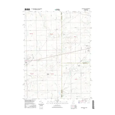
2016 Map of Butler East
USGS Topo · Published 2016About this map
Butler anchors the western edge of this survey, where the street grid fans out along E Main St and S Broadway St near the historical rail corridor at Depot St. The landscape east of town is defined by an intricate network of agricultural drainage and natural waterways, including the winding course of the Saint Joseph River and the rural crossing at Clarksville Bridge. This area, straddling the Indiana-Ohio border, reveals a distribution of small rural hubs like Artic, Edgerton, and Stafford Center.
Find a feature on this map
86 named features on this map. Tap any name to fly to it.
Don’t see what you’re looking for? This feature index may not catch every label — zoom into the map to look around manually.
Map Details
Editions of this 2016 Butler East Map
This is the sole edition of this map. No revisions or reprints were ever made.
Other maps of this area

1914 · Pioneer
USGS Topo · 1:62,500

1914 · Bryan
USGS Topo · 1:62,500

1939 · Hamilton
USGS Topo · 1:24,000

1940 · Metz
USGS Topo · 1:24,000

1943 · Bryan
USGS Topo · 1:62,500

1944 · Pioneer
USGS Topo · 1:62,500

1948 · Hamilton
USGS Topo · 1:24,000

1953 · Fort Wayne
USGS Topo · 1:250,000

1956 · Fort Wayne
USGS Topo · 1:250,000

1958 · Hicksville
USGS Topo · 1:24,000