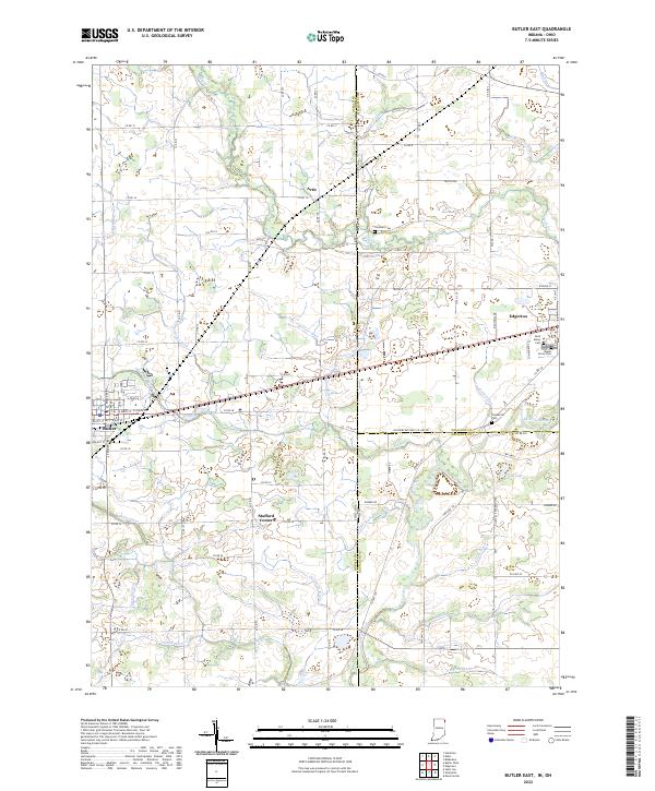
2022 Map of Butler East
USGS Topo · Published 2022About this map
The Saint Joseph River and its intricate network of tributaries define this section of the Indiana and Ohio borderlands. Small settlements such as Artic, Stafford Center, and the village of Edgerton dot a landscape engineered for drainage, as evidenced by the numerous named channels like Walters Ditch, Christoffel Ditch, and Ziegler Ditch. This 2022 survey illustrates the persistent agricultural and rural character of DeKalb and Williams Counties, where the land is partitioned into a strict grid of county roads.
Find a feature on this map
93 named features on this map. Tap any name to fly to it.
Don’t see what you’re looking for? This feature index may not catch every label — zoom into the map to look around manually.
Map Details
Editions of this 2022 Butler East Map
This is the sole edition of this map. No revisions or reprints were ever made.
Other maps of this area

1914 · Pioneer
USGS Topo · 1:62,500

1914 · Bryan
USGS Topo · 1:62,500

1939 · Hamilton
USGS Topo · 1:24,000

1940 · Metz
USGS Topo · 1:24,000

1943 · Bryan
USGS Topo · 1:62,500

1944 · Pioneer
USGS Topo · 1:62,500

1948 · Hamilton
USGS Topo · 1:24,000

1953 · Fort Wayne
USGS Topo · 1:250,000

1956 · Fort Wayne
USGS Topo · 1:250,000

1958 · Hicksville
USGS Topo · 1:24,000