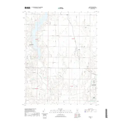
2018 Map of Butler
USGS Topo · Published 2018About this map
Lake Lou Yaeger dominates the northwest quadrant of this Montgomery County landscape, its irregular shoreline reaching deep into the agricultural terrain between Litchfield and Butler. This survey captures the transition from the concentrated residential streets of Hillsboro to the expansive industrial footprint represented by the American Zinc Smelter Company Large Lake near Taylor Springs. The map is particularly useful for genealogists, as it identifies numerous historic burial grounds including Ware's Grove Cem, Butler Cem, and Saint Agnes Cem north of Hillsboro. Topographic landmarks like Cress Hill and Huber Hill rise above the drainage systems of Brush Cr and Cress Cr, illustrating the natural relief of the Illinois prairie alongside modern features such as Justison Airport.
Find a feature on this map
86 named features on this map. Tap any name to fly to it.
Don’t see what you’re looking for? This feature index may not catch every label — zoom into the map to look around manually.
Map Details
Editions of this 2018 Butler Map
This is the sole edition of this map. No revisions or reprints were ever made.
Other maps of this area

1915 · Mount Olive
USGS Topo · 1:62,500

1923 · Raymond
USGS Topo · 1:62,500

1925 · Raymond
USGS Topo · 1:62,500

1944 · Mount Olive
USGS Topo · 1:62,500

1946 · Nokomis
USGS Topo · 1:62,500

1947 · Hillsboro
USGS Topo · 1:62,500

1949 · Hillsboro
USGS Topo · 1:62,500

1949 · Nokomis
USGS Topo · 1:62,500

1958 · Decatur
USGS Topo · 1:250,000

1961 · Decatur
USGS Topo · 1:250,000