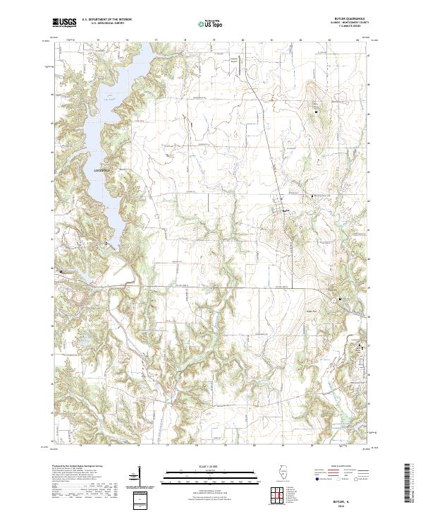
2024 Map of Butler
USGS Topo · Published 2024About this map
Lake Lou Yaeger dominates the western landscape of this Illinois quadrangle, creating a complex shoreline that borders the eastern edge of Litchfield. The terrain is defined by the drainage networks of West Fork Shoal Creek and Brush Creek, which carve through the Montgomery County countryside toward the smaller village of Butler. This area maintains a strong connection to its local heritage, evidenced by numerous historical burial grounds like Wares Grove Cem and Blooming Grove Cem tucked away on county roads.
Find a feature on this map
88 named features on this map. Tap any name to fly to it.
Don’t see what you’re looking for? This feature index may not catch every label — zoom into the map to look around manually.
Map Details
Editions of this 2024 Butler Map
This is the sole edition of this map. No revisions or reprints were ever made.
Other maps of this area

1915 · Mount Olive
USGS Topo · 1:62,500

1923 · Raymond
USGS Topo · 1:62,500

1925 · Raymond
USGS Topo · 1:62,500

1944 · Mount Olive
USGS Topo · 1:62,500

1946 · Nokomis
USGS Topo · 1:62,500

1947 · Hillsboro
USGS Topo · 1:62,500

1949 · Hillsboro
USGS Topo · 1:62,500

1949 · Nokomis
USGS Topo · 1:62,500

1958 · Decatur
USGS Topo · 1:250,000

1961 · Decatur
USGS Topo · 1:250,000