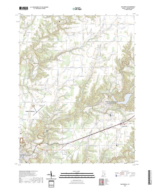
2022 Map of Butlerville
USGS Topo · Published 2022About this map
The Vernon Fork Muscatatuck River carves a winding path across this Jennings County landscape, defining the topography between the settlements of North Vernon and Butlerville. This 2022 survey captures the region's agricultural character, where a dense grid of county roads connects numerous local landmarks of genealogical significance. Scattered across the township lines of t8n r8e and t7n r9e are several historic burial grounds, including the State School Cem and Bear Creek Cem.
Find a feature on this map
62 named features on this map. Tap any name to fly to it.
Don’t see what you’re looking for? This feature index may not catch every label — zoom into the map to look around manually.
Map Details
Editions of this 2022 Butlerville Map
This is the sole edition of this map. No revisions or reprints were ever made.
Other maps of this area

1942 · Columbus
USGS Topo · 1:125,000

1953 · Cincinnati
USGS Topo · 1:250,000

1956 · Louisville
USGS Topo · 1:250,000

1957 · Cincinnati
USGS Topo · 1:250,000

1957 · Butlerville
USGS Topo · 1:24,000

1957 · North Vernon
USGS Topo · 1:24,000

1958 · Millhousen
USGS Topo · 1:24,000

1958 · Westport
USGS Topo · 1:24,000

1958 · Grammer
USGS Topo · 1:24,000

1959 · Holton
USGS Topo · 1:24,000