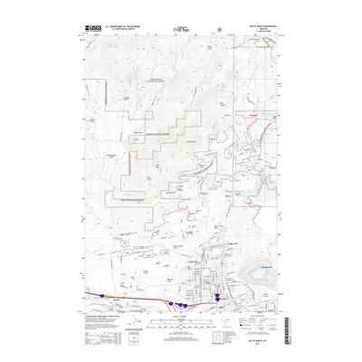
2014 Map of Butte North
USGS Topo · Published 2014About this map
Walkerville and the northern reaches of Butte dominate the lower half of this landscape, where the urban grid meets the steep slopes of Steep Mtn. The transition from city to wilderness is stark, marked by the boundaries of the Deerlodge National Forest and the winding Continental Divide at the county line. The map captures a complex industrial and natural interface, showing numerous DNF (Do Not Fill) mine-related areas scattered through gulches like Beer Straight Gulch and Whiskey Gulch. Local infrastructure is prominent, from the Moulton Reservoir Number One to the dense street network of Centerville and Pioneer. The topography is defined by a succession of drainages such as Bull Run Cr and Yankee Doodle Creek, illustrating the challenging terrain that shaped the development of one of Montana's most significant mining districts.
Find a feature on this map
110 named features on this map. Tap any name to fly to it.
Don’t see what you’re looking for? This feature index may not catch every label — zoom into the map to look around manually.
Map Details
Editions of this 2014 Butte North Map
This is the sole edition of this map. No revisions or reprints were ever made.
Other maps of this area

1889 · Helena
USGS Topo · 1:250,000

1893 · Helena
USGS Topo · 1:250,000

1893 · Dillon
USGS Topo · 1:250,000

1899 · Boulder
USGS Topo · 1:125,000

1899 · Helena
USGS Topo · 1:250,000

1903 · Helena
USGS Topo · 1:250,000

1947 · Butte
USGS Topo · 1:250,000

1954 · Elk Park
USGS Topo · 1:62,500

1955 · Dillon
USGS Topo · 1:250,000

1957 · Dillon
USGS Topo · 1:250,000