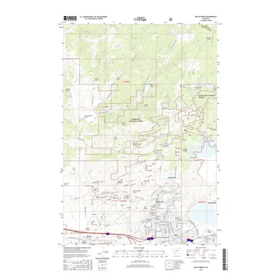
2017 Map of Butte North
USGS Topo · Published 2017About this map
The Continental Divide winds through the high country north of the famed copper mining city, framing a landscape defined by industrial history and steep mountain terrain. The historic mining settlements of Walkerville, Centerville, and Meaderville are clustered at the edge of the urban grid, while Montana Tech of the Univ of Montana (formerly the School of Mines) sits at the base of Big Butte. The map reveals a complex network of canyons and gulches, such as Oro Fino Gulch and Beer Straight Gulch, that once bustled with activity. To the north, the Deerlodge National Forest provides a stark contrast with its managed wilderness, featuring the Moulton Reservoir Number One and a series of rugged drainage paths including Italian Gulch and Deep Canyon. This area represents the intersection of one of the world's most significant mining districts with the expansive natural geography of the Rocky Mountains, traced here through modern infrastructure and historic place names.
Find a feature on this map
97 named features on this map. Tap any name to fly to it.
Don’t see what you’re looking for? This feature index may not catch every label — zoom into the map to look around manually.
Map Details
Editions of this 2017 Butte North Map
This is the sole edition of this map. No revisions or reprints were ever made.
Other maps of this area

1889 · Helena
USGS Topo · 1:250,000

1893 · Helena
USGS Topo · 1:250,000

1893 · Dillon
USGS Topo · 1:250,000

1899 · Boulder
USGS Topo · 1:125,000

1899 · Helena
USGS Topo · 1:250,000

1903 · Helena
USGS Topo · 1:250,000

1947 · Butte
USGS Topo · 1:250,000

1954 · Elk Park
USGS Topo · 1:62,500

1955 · Dillon
USGS Topo · 1:250,000

1957 · Dillon
USGS Topo · 1:250,000