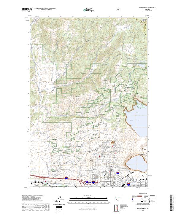
2024 Map of Butte North
USGS Topo · Published 2024About this map
The Boulder Mountains and the Continental Divide dominate the northern landscape of this region, providing a high-altitude backdrop to the historic mining and urban centers of Silver Bow County. To the south, the city of Butte and its neighboring settlements like Walkerville and Centerville reveal the dense street grids and institutional landmarks that defined this high-desert industrial hub. Notable civic features include the Butte-Silver Bow County Courthouse and the campus of Montana Technological University, while the surrounding terrain is deeply etched with drainages like Hail Columbia Gulch and Butcher Gulch. The map captures a complex environment where industrial infrastructure meets the protected lands of the Deerlodge National Forest, alongside vital water resources such as Moulton Reservoir Number One and Silver Bow Creek. Small outlying communities like Rocker sit near the junction of major transit routes, reflecting the area's continued importance as a mountain crossroads.
Find a feature on this map
60 named features on this map. Tap any name to fly to it.
Don’t see what you’re looking for? This feature index may not catch every label — zoom into the map to look around manually.
Map Details
Editions of this 2024 Butte North Map
This is the sole edition of this map. No revisions or reprints were ever made.
Other maps of this area

1889 · Helena
USGS Topo · 1:250,000

1893 · Helena
USGS Topo · 1:250,000

1893 · Dillon
USGS Topo · 1:250,000

1899 · Boulder
USGS Topo · 1:125,000

1899 · Helena
USGS Topo · 1:250,000

1903 · Helena
USGS Topo · 1:250,000

1947 · Butte
USGS Topo · 1:250,000

1954 · Elk Park
USGS Topo · 1:62,500

1955 · Dillon
USGS Topo · 1:250,000

1957 · Dillon
USGS Topo · 1:250,000