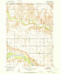
1951 Map of Butte NW
USGS Topo · Published 1951About this map
The Niobrara River and its confluence with the Keya Paha River anchor this mid-century survey of the Nebraska-South Dakota borderlands. Published as part of the Department of the Interior program for the development of the Missouri River Basin, the topography reveals a landscape of high prairie plateaus and deeply carved drainages. The rural settlement pattern of the early 1950s is defined by a dense network of numbered school districts, which were the primary civic anchors for families farming in Pleasant Valley and the McCully area.
Find a feature on this map
17 named features on this map. Tap any name to fly to it.
Don’t see what you’re looking for? This feature index may not catch every label — zoom into the map to look around manually.
Map Details
Editions of this 1951 Butte NW Map
2 editions found
Other maps of this area

1951 · Butte NW
USGS Topo · 1:24,000

1951 · Naper
USGS Topo · 1:24,000

1951 · Butte SW
USGS Topo · 1:24,000

1951 · Dustin
USGS Topo · 1:24,000

1952 · Butte SE
USGS Topo · 1:24,000

1955 · Mitchell
USGS Topo · 1:250,000

1955 · O'Neill
USGS Topo · 1:250,000

1959 · O'Neill
USGS Topo · 1:250,000

1959 · Mitchell
USGS Topo · 1:250,000

1964 · Butte
USGS Topo · 1:24,000