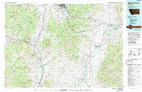
1975 Map of Butte South
USGS Topo · Published 1975About this map
Butte sits at the northern edge of this 1970s landscape, where industrial activity and complex geography meet along the Continental Divide. The map illustrates a region defined by its rich mineral heritage, with numerous active and historical operations such as the Watseca Mine, Hecla Mines, and Silver Star Mine dotting the mountainous terrain. These sites are connected by the Burlington Northern railroad, which follows the natural corridors carved by the Big Hole River and Jefferson River.
Find a feature on this map
130 named features on this map. Tap any name to fly to it.
Don’t see what you’re looking for? This feature index may not catch every label — zoom into the map to look around manually.
Map Details
Editions of this 1975 Butte South Map
This is the sole edition of this map. No revisions or reprints were ever made.
Other maps of this area

1886 · Fort Logan
USGS Topo · 1:250,000

1888 · Three Forks
USGS Topo · 1:250,000

1889 · Helena
USGS Topo · 1:250,000

1893 · Helena
USGS Topo · 1:250,000

1893 · Dillon
USGS Topo · 1:250,000

1894 · Three Forks
USGS Topo · 1:250,000

1895 · Three Forks
USGS Topo · 1:250,000

1899 · Boulder
USGS Topo · 1:125,000

1899 · Helena
USGS Topo · 1:250,000

1903 · Helena
USGS Topo · 1:250,000