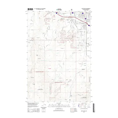
2014 Map of Butte South
USGS Topo · Published 2014About this map
Butte and its southern suburbs occupy the high mountain landscape where Silver Bow Cr flows through the valley floor. This 2014 survey documents the dense residential grid of the city alongside the industrial and aviation footprint of Bert Mooney Airport. The map is particularly rich for genealogical research, identifying several major burial grounds north of Timber Butte, including Saint Patrick Cem, Mt Moriah Cem, and B'Nai Israel Cem. South of the urban center, the terrain rises sharply toward the Continental Divide, which zigzags across the Deerlodge National Forest. This transition from the urban street networks of Williamsburg to the drainage systems of Basin Cr and Little Basin Cr illustrates the relationship between Montana's mining-era settlements and the surrounding wilderness.
Find a feature on this map
130 named features on this map. Tap any name to fly to it.
Don’t see what you’re looking for? This feature index may not catch every label — zoom into the map to look around manually.
Map Details
Editions of this 2014 Butte South Map
This is the sole edition of this map. No revisions or reprints were ever made.
Other maps of this area

1889 · Helena
USGS Topo · 1:250,000

1893 · Helena
USGS Topo · 1:250,000

1893 · Dillon
USGS Topo · 1:250,000

1899 · Boulder
USGS Topo · 1:125,000

1899 · Helena
USGS Topo · 1:250,000

1903 · Helena
USGS Topo · 1:250,000

1947 · Butte
USGS Topo · 1:250,000

1954 · Elk Park
USGS Topo · 1:62,500

1955 · Dillon
USGS Topo · 1:250,000

1957 · Dillon
USGS Topo · 1:250,000