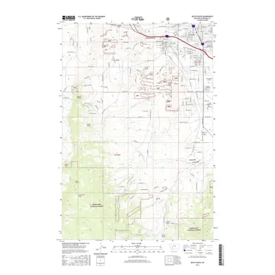
2017 Map of Butte South
USGS Topo · Published 2017About this map
Butte serves as the northern anchor for this study of the high-altitude Montana landscape, where urban grid-work gives way to the complex industrial and natural features of the Deerlodge National Forest. The map documents a significant concentration of burial grounds including Mount Moriah Cem, B'Nai Israel Cem, and Saint Patrick Cem, reflecting the diverse cultural history of the mining district. The transition from city to mountains is marked by Timber Butte and the sprawling facilities of the Montana Tech Coll of Technology and Bert Mooney Airport. Further south, the landscape is defined by the Continental Divide and the headwaters of numerous drainages such as Blacktail Cr and Little Basin Cr. Small clusters of development like Williamsburg and Newcomb sit along the creek valleys, tracing the legacy of settlement and transportation routes through the gulches.
Find a feature on this map
125 named features on this map. Tap any name to fly to it.
Don’t see what you’re looking for? This feature index may not catch every label — zoom into the map to look around manually.
Map Details
Editions of this 2017 Butte South Map
This is the sole edition of this map. No revisions or reprints were ever made.
Other maps of this area

1889 · Helena
USGS Topo · 1:250,000

1893 · Helena
USGS Topo · 1:250,000

1893 · Dillon
USGS Topo · 1:250,000

1899 · Boulder
USGS Topo · 1:125,000

1899 · Helena
USGS Topo · 1:250,000

1903 · Helena
USGS Topo · 1:250,000

1947 · Butte
USGS Topo · 1:250,000

1954 · Elk Park
USGS Topo · 1:62,500

1955 · Dillon
USGS Topo · 1:250,000

1957 · Dillon
USGS Topo · 1:250,000