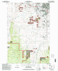
1996 Map of Butte South
USGS Topo · Published 1998About this map
Butte and the industrial suburbs of Williamsburg and Cobban anchor the northern landscape of this 1990s survey, illustrating the urban footprint of one of Montana's most significant mining hubs. The city's social history is deeply etched into the terrain through a concentrated cluster of memorial sites, including Mount Moriah Cemetery, B Nai Israel Cemetery, and St Patrick Cemetery. The presence of these diverse cemeteries alongside institutions like the Webster Garfield School and Longfellow School provides a clear view of the established residential neighborhoods that grew south toward Stodden Park.
Find a feature on this map
40 named features on this map. Tap any name to fly to it.
Don’t see what you’re looking for? This feature index may not catch every label — zoom into the map to look around manually.
Map Details
Editions of this 1996 Butte South Map
This is the sole edition of this map. No revisions or reprints were ever made.
Other maps of this area

1889 · Helena
USGS Topo · 1:250,000

1893 · Helena
USGS Topo · 1:250,000

1893 · Dillon
USGS Topo · 1:250,000

1899 · Boulder
USGS Topo · 1:125,000

1899 · Helena
USGS Topo · 1:250,000

1903 · Helena
USGS Topo · 1:250,000

1947 · Butte
USGS Topo · 1:250,000

1954 · Elk Park
USGS Topo · 1:62,500

1955 · Dillon
USGS Topo · 1:250,000

1957 · Dillon
USGS Topo · 1:250,000