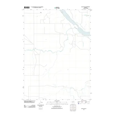
2011 Map of Butte SW
USGS Topo · Published 2011About this map
The Niobrara River carves a significant path through this section of Holt County, defining a landscape shaped by its winding channel and the drainage of several prominent tributaries. To the north, Hull Lake and the associated Hull Dam mark a point of water management and local geography. The area's rural character is further detailed by the presence of Adams Cemetery, a site of genealogical interest situated away from the primary river corridor. A complex network of waterways, including the meandering Big Sandy Creek, Little Sandy Creek, and Brush Creek, crisscross the territory, illustrating the natural irrigation and topography of the Nebraska plains. Aside from the arterial River Rd, the map shows a sparse grid of local roads typical of this agricultural and ranching region.
Find a feature on this map
8 named features on this map. Tap any name to fly to it.
Don’t see what you’re looking for? This feature index may not catch every label — zoom into the map to look around manually.
Map Details
Editions of this 2011 Butte SW Map
This is the sole edition of this map. No revisions or reprints were ever made.
Other maps of this area

1951 · Butte NW
USGS Topo · 1:24,000

1951 · Naper
USGS Topo · 1:24,000

1951 · Butte SW
USGS Topo · 1:24,000

1951 · Dustin
USGS Topo · 1:24,000

1952 · Butte SE
USGS Topo · 1:24,000

1954 · Atkinson NW
USGS Topo · 1:24,000

1954 · Atkinson NE
USGS Topo · 1:24,000

1954 · Stuart NE
USGS Topo · 1:24,000

1955 · O'Neill
USGS Topo · 1:250,000

1959 · O'Neill
USGS Topo · 1:250,000