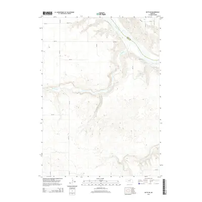
2014 Map of Butte SW
USGS Topo · Published 2014About this map
The Niobrara River carves a dramatic path along the border of Boyd Co and Holt Co in this 2014 landscape. This rural section of Nebraska is defined by its drainage network, where Big Sandy Cr and Little Sandy Cr feed into the larger river valley. Further south, the meandering course of Brush Cr cuts through the sectioned plains. For those researching local family history, Adams Cem is a significant landmark located in the northwestern portion of the map near Adams Cem. The map reveals a transition from the structured grid of section roads like 480th Ave to the complex topography of the river bluffs. In the northeast corner, Hull Lake sits near the junction of Juniper Rd and 481st Ave, providing a specific point of interest in an otherwise agricultural and riparian terrain.
Find a feature on this map
18 named features on this map. Tap any name to fly to it.
Don’t see what you’re looking for? This feature index may not catch every label — zoom into the map to look around manually.
Map Details
Editions of this 2014 Butte SW Map
This is the sole edition of this map. No revisions or reprints were ever made.
Other maps of this area

1951 · Butte NW
USGS Topo · 1:24,000

1951 · Naper
USGS Topo · 1:24,000

1951 · Butte SW
USGS Topo · 1:24,000

1951 · Dustin
USGS Topo · 1:24,000

1952 · Butte SE
USGS Topo · 1:24,000

1954 · Atkinson NW
USGS Topo · 1:24,000

1954 · Atkinson NE
USGS Topo · 1:24,000

1954 · Stuart NE
USGS Topo · 1:24,000

1955 · O'Neill
USGS Topo · 1:250,000

1959 · O'Neill
USGS Topo · 1:250,000