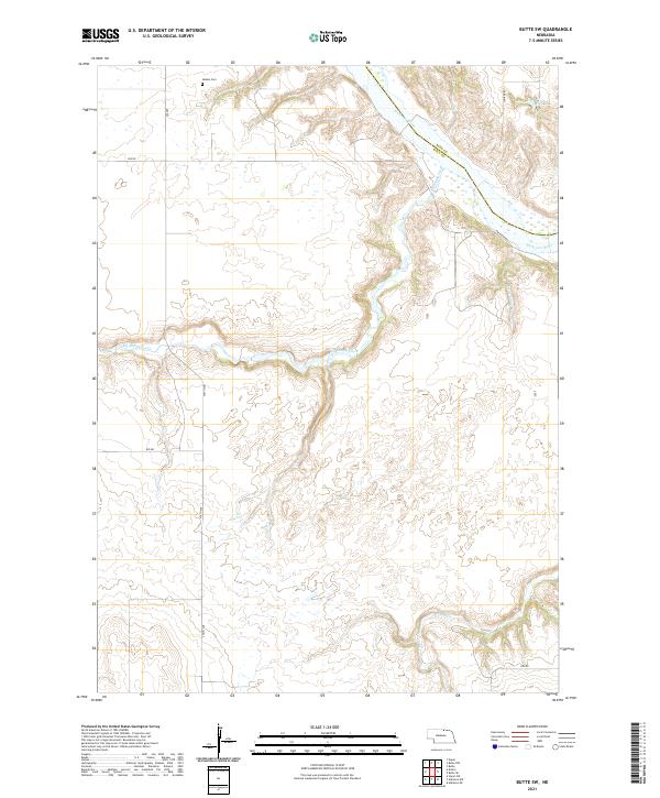
2021 Map of Butte SW
USGS Topo · Published 2021About this map
Adams Cem sits near the northern boundary of this territory, overlooking the drainage basin where the Niobrara River carves through the landscape. This portion of the Nebraska backcountry is defined by a network of seasonal and perennial waterways, including the winding Big Sandy Creek, Little Sandy Cr, and Brush Cr. The terrain is marked by the distinct transition from high tablelands down into the river breaks, a geography that dictated the placement of early rural infrastructure.
Find a feature on this map
19 named features on this map. Tap any name to fly to it.
Don’t see what you’re looking for? This feature index may not catch every label — zoom into the map to look around manually.
Map Details
Editions of this 2021 Butte SW Map
This is the sole edition of this map. No revisions or reprints were ever made.
Other maps of this area

1951 · Butte NW
USGS Topo · 1:24,000

1951 · Naper
USGS Topo · 1:24,000

1951 · Butte SW
USGS Topo · 1:24,000

1951 · Dustin
USGS Topo · 1:24,000

1952 · Butte SE
USGS Topo · 1:24,000

1954 · Atkinson NW
USGS Topo · 1:24,000

1954 · Atkinson NE
USGS Topo · 1:24,000

1954 · Stuart NE
USGS Topo · 1:24,000

1955 · O'Neill
USGS Topo · 1:250,000

1959 · O'Neill
USGS Topo · 1:250,000