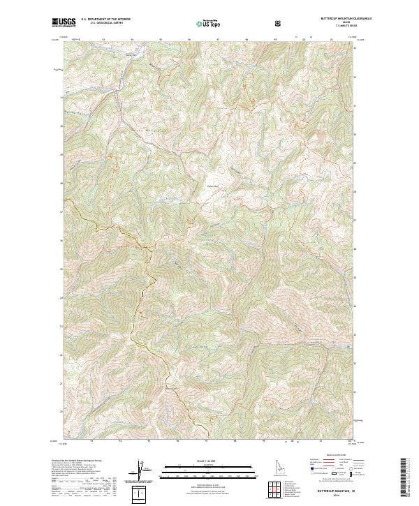
2024 Map of Buttercup Mountain
USGS Topo · Published 2024About this map
Buttercup Mtn rises above a landscape defined by deep drainages and expansive national forest land in the Smoky Mountains. Located within the Sawtooth National Forest, this area serves as a significant drainage basin for Warm Springs Creek and its many tributaries, including the Middle Fork Warm Springs Creek and South Fork Warm Springs Creek. The map shows a complex network of forest routes, such as the Warm Springs Creek Rd and Deer Creek Rd, which provide access to the remote gulches and flats.
Find a feature on this map
56 named features on this map. Tap any name to fly to it.
Don’t see what you’re looking for? This feature index may not catch every label — zoom into the map to look around manually.
Map Details
Editions of this 2024 Buttercup Mountain Map
This is the sole edition of this map. No revisions or reprints were ever made.
Other maps of this area

1895 · Hailey
USGS Topo · 1:125,000

1897 · Hailey
USGS Topo · 1:125,000

1900 · Sawtooth
USGS Topo · 1:125,000

1955 · Hailey
USGS Topo · 1:250,000

1957 · Bellevue
USGS Topo · 1:62,500

1957 · Blaine
USGS Topo · 1:62,500

1959 · Hailey
USGS Topo · 1:250,000

1962 · Hailey
USGS Topo · 1:250,000

1967 · Mahoney Butte
USGS Topo · 1:24,000
1967 · Griffin Butte
USGS Topo · 1:24,000