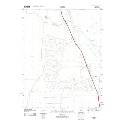
2010 Map of Buttes
USGS Topo · Published 2010About this map
Fountain Creek and the drainage of Sand Creek define this landscape south of Colorado Springs as it appeared in the early 21st century. The map centers on the community of Buttes, where the infrastructure of the R D Nixon Dam and R D Nixon Reservoir stands as a significant hydrological landmark. This area showcases a transition from traditional agricultural land use, evidenced by the 7 L Bar Ranch and Midway Ranch, to a modern network of planned residential streets with evocative western names like Rattlesnake Pt and Ghost Walk Pt.
Find a feature on this map
60 named features on this map. Tap any name to fly to it.
Don’t see what you’re looking for? This feature index may not catch every label — zoom into the map to look around manually.
Map Details
Editions of this 2010 Buttes Map
This is the sole edition of this map. No revisions or reprints were ever made.
Other maps of this area

1891 · Pueblo
USGS Topo · 1:125,000

1893 · Colorado Springs
USGS Topo · 1:125,000

1894 · Pueblo
USGS Topo · 1:125,000

1896 · Pueblo
USGS Topo · 1:125,000

1897 · Pueblo
USGS Topo · 1:125,000

1909 · Colorado Springs
USGS Topo · 1:125,000

1942 · Colorado Springs
USGS Topo · 1:125,000

1948 · Timber Mountain
USGS Topo · 1:24,000

1948 · Fountain SE
USGS Topo · 1:24,000

1948 · Fountain
USGS Topo · 1:24,000