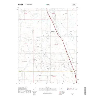
2019 Map of Buttes
USGS Topo · Published 2019About this map
Fountain Creek bisects this landscape, shaping a corridor of transportation and water management south of the city of Fountain. The presence of the Cotton Slough Ditch and Jackson and Burke Ditch highlights the critical role of irrigation in this semi-arid region, while the R D Nixon Reservoir stands as a major industrial water feature in the north. The area's transportation history is represented by the Old Pueblo Rd and the Fountain Creek Regional Trail, which follow the natural drainage of the valley.
Find a feature on this map
81 named features on this map. Tap any name to fly to it.
Don’t see what you’re looking for? This feature index may not catch every label — zoom into the map to look around manually.
Map Details
Editions of this 2019 Buttes Map
This is the sole edition of this map. No revisions or reprints were ever made.
Other maps of this area

1891 · Pueblo
USGS Topo · 1:125,000

1893 · Colorado Springs
USGS Topo · 1:125,000

1894 · Pueblo
USGS Topo · 1:125,000

1896 · Pueblo
USGS Topo · 1:125,000

1897 · Pueblo
USGS Topo · 1:125,000

1909 · Colorado Springs
USGS Topo · 1:125,000

1942 · Colorado Springs
USGS Topo · 1:125,000

1948 · Timber Mountain
USGS Topo · 1:24,000

1948 · Fountain SE
USGS Topo · 1:24,000

1948 · Fountain
USGS Topo · 1:24,000