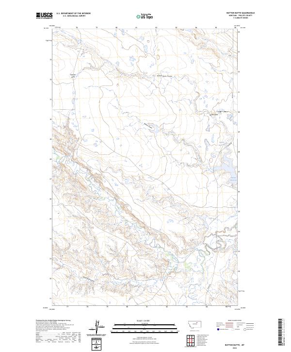
2024 Map of Button Butte
USGS Topo · Published 2024About this map
Rudolph Valley defines the northern reaches of this Phillips County landscape, where the terrain transitions from broad flats into the intricate drainages of the Missouri River breaks. The prominence of Button Butte serves as a central landmark overlooking Button Butte Coulee and Nelson Coulee. These ephemeral waterways carve through the rangeland, eventually giving way to the substantial waters of the Nelson Reservoir in the east.
Find a feature on this map
13 named features on this map. Tap any name to fly to it.
Don’t see what you’re looking for? This feature index may not catch every label — zoom into the map to look around manually.
Map Details
Editions of this 2024 Button Butte Map
This is the sole edition of this map. No revisions or reprints were ever made.
Other maps of this area

1953 · Havre
USGS Topo · 1:250,000

1954 · Jordan
USGS Topo · 1:250,000

1954 · Glasgow
USGS Topo · 1:250,000

1954 · Lewistown
USGS Topo · 1:250,000

1956 · Jordan
USGS Topo · 1:250,000

1957 · Glasgow
USGS Topo · 1:250,000

1957 · Havre
USGS Topo · 1:250,000

1958 · Glasgow
USGS Topo · 1:250,000

1958 · Jordan
USGS Topo · 1:250,000

1958 · Havre
USGS Topo · 1:250,000