
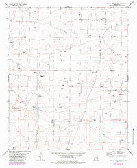
1978 Map of Button Mesa North
USGS Topo · Published 1986About this map
The Chaveroo Oil Field dominates the eastern reaches of this High Plains landscape, where industrial infrastructure meets the arid terrain of Roosevelt and Chaves counties. Numerous named water sources, such as Boatwright Well, Baliff Well, and Mc Lorn Well, are scattered across the survey, underscoring the vital importance of groundwater for both ranching and petroleum operations in this region of eastern New Mexico. The topography is defined by the prominent Button Mesa and the nearby Vest Lake, with several Jeep Trails providing the primary means of navigating between the isolated drilling sites and gravel pits. These features suggest an economy centered on extraction and livestock, where the distribution of wells like First West Well and Jones Well tracks the historical development of the local water and mineral rights.
Find a feature on this map
18 named features on this map. Tap any name to fly to it.
Don’t see what you’re looking for? This feature index may not catch every label — zoom into the map to look around manually.
Map Details
Editions of this 1978 Button Mesa North Map
This is the sole edition of this map. No revisions or reprints were ever made.
Other maps of this area

1954 · Brownfield
USGS Topo · 1:250,000

1958 · Brownfield
USGS Topo · 1:250,000

1962 · Brownfield
USGS Topo · 1:250,000

1978 · Flying M Ranch
USGS Topo · 1:24,000

1979 · Kenna
USGS Topo · 1:24,000
1979 · Schram Lake
USGS Topo · 1:24,000
1979 · Curlew Lake SE
USGS Topo · 1:24,000
1979 · Elida SE
USGS Topo · 1:24,000
1979 · Lone Wolf
USGS Topo · 1:24,000
1979 · Button Mesa South
USGS Topo · 1:24,000